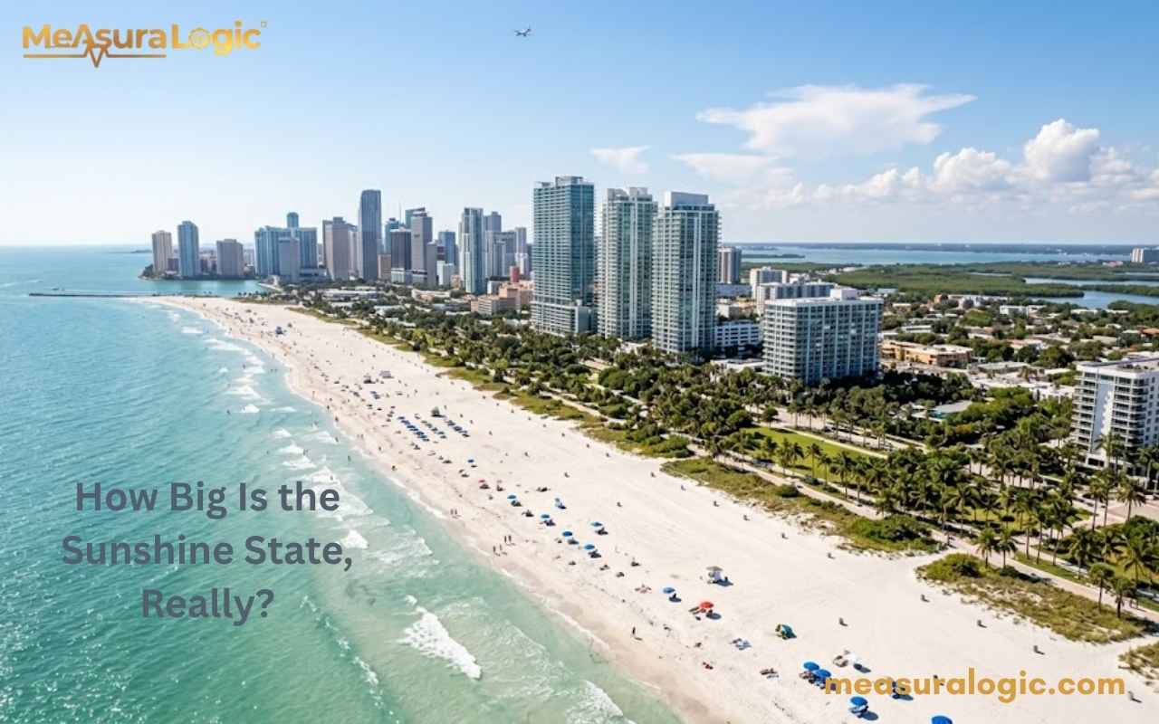
Most people picture Florida as a narrow little peninsula dangling off the bottom of the United States. Here is the thing, that picture is almost completely wrong.
Florida is massive. It stretches farther north to south than most Europeans travel in a weekend road trip. Its largest city covers more land than Los Angeles, New York, and Chicago combined. And yet, somehow, Florida remains one of the most underestimated states.
Whether you are a traveler, a student researching U.S. geography, or just someone who loves fascinating facts — this guide breaks down Florida’s dimensions, geography, and everything in between. Let’s dig in.
Florida History Through a Geographic Lens
Geography shaped Florida from the start. Spanish explorer Juan Ponce de León arrived in 1513 drawn by rumors of rich lands and a legendary fountain of youth. Statehood 1845 brought Florida into the Union as the 27th state, but the swampy interior made it brutal to govern. The Seminole Wars played out across the very wetlands that made colonization nearly impossible.
Eventually, Henry Flagler’s East Coast Railway in the 1890s cracked the state open for mass settlement. Civil War, Reconstruction, and the railroad together transformed this stubborn southeastern state from an ungovernable wilderness into the booming powerhouse it is today.
Read about 16 Things That Are 100 Feet (ft) Long
Florida By The Numbers
Before diving into the details, here is a clean snapshot of the state size and key land measurements.
| Dimension | Imperial | Metric |
|---|---|---|
| Total Area | 65,758 sq mi | 170,312 km² |
| Land Area | 53,625 sq mi | 138,887 km² |
| Water Area | 12,133 sq mi | 31,424 km² |
| North-to-South Length | ~447 miles | ~719 km |
| East-to-West Width (widest) | ~361 miles | ~581 km |
| Peninsula Narrowest Point | ~160 miles | ~257 km |
| Coastline Length | 1,350 miles | 2,173 km |
| Tidal Shoreline | 8,436 miles | 13,576 km |
| U.S. Size Rank | 22nd | — |
Length and Width: How Long and Wide Is Florida?

North to South
Florida runs approximately 447 miles from its northern border to the southern tip of the mainland. If you add the Florida Keys dangling southward, that number stretches even further — with Key West sitting at 24.5°N latitude, nearly as far south as the Bahamas.
To put that in perspective: driving from Pensacola in the far northwest to Key West at the southern tip takes over 12 hours without stops. That is roughly the same driving time as London to Edinburgh and back.
East to West
At its widest point, across the Panhandle, Florida stretches approximately 361 miles east to west. The peninsula itself narrows significantly as you move south, pinching to roughly 160 miles across at its slimmest. That narrowing is part of what creates Florida’s iconic shape on a map.
The Latitude Factor
Florida spans from 24°N to 31°N latitude. That 7-degree range means the northern parts of the state experience cool winters — occasionally even frost — while South Florida basks in year-round tropical warmth. The same state size contains climates that feel like completely different countries.
The Florida Panhandle vs. The Peninsula
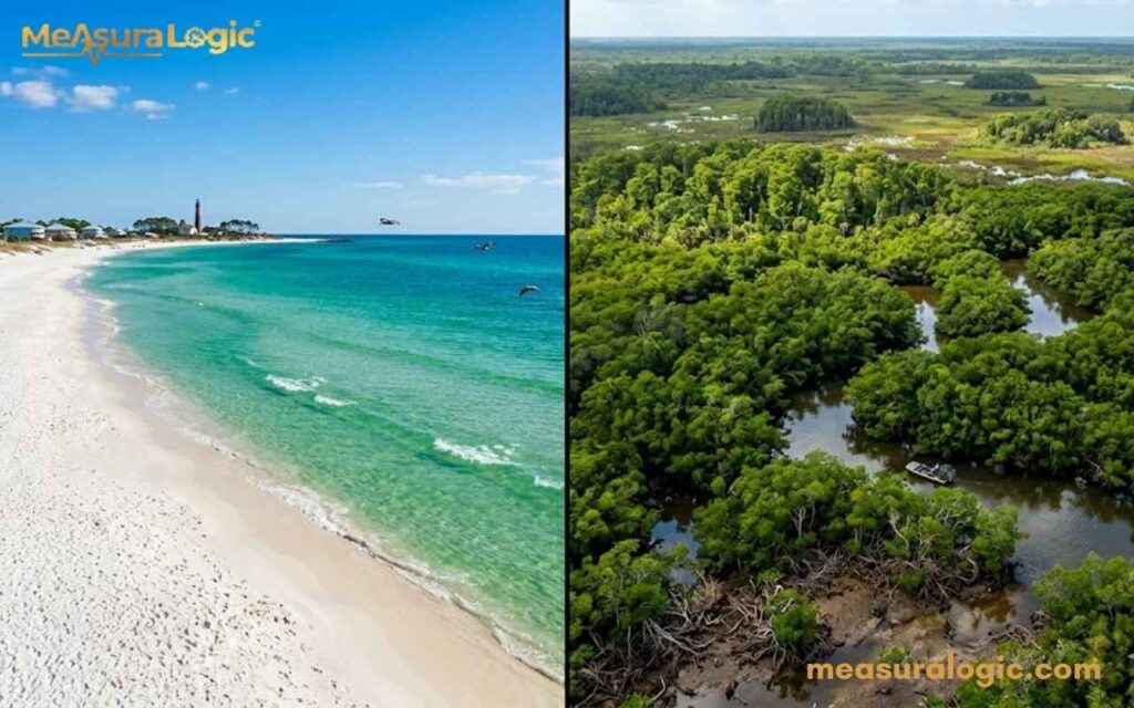
Here is something most casual Florida visitors do not fully appreciate: the state has two geographically distinct personalities.
Learn about, 20 Feet: 24 Real Things That Are About This Long
The Florida Panhandle
The Florida Panhandle is the horizontal strip running west from Tallahassee toward Alabama. It is northern Florida at its most Southern — culturally closer to Georgia and Alabama than to Miami. Cities like Pensacola and Destin anchor this region, offering Gulf beaches with sugar-white sand and emerald water that rival anywhere in the Caribbean.
The Panhandle sits at a higher latitude, meaning cooler winters and a climate that actually experiences four seasons. Historic towns dot the region, carrying echoes of colonial Florida and Civil War history.
The Peninsula
The peninsula is what most people picture when they think “Florida.” It is the long tongue of land pushing southward between the Atlantic Ocean and the Gulf of Mexico. As it narrows toward the south, it eventually gives way to the Everglades, then the Florida Keys archipelago trailing off toward Cuba.
Elevation: America’s Flattest State
Here is a wild fact. Florida’s highest natural point is Britton Hill in the Panhandle — just 345 feet above sea level. That makes Florida the flattest state in the entire country. For comparison, Kansas — famously ridiculed for being flat — has a high point over 4,000 feet. Florida’s “mountain” would not even qualify as a decent hill in Colorado.
Florida’s Coastline: The Real Showstopper
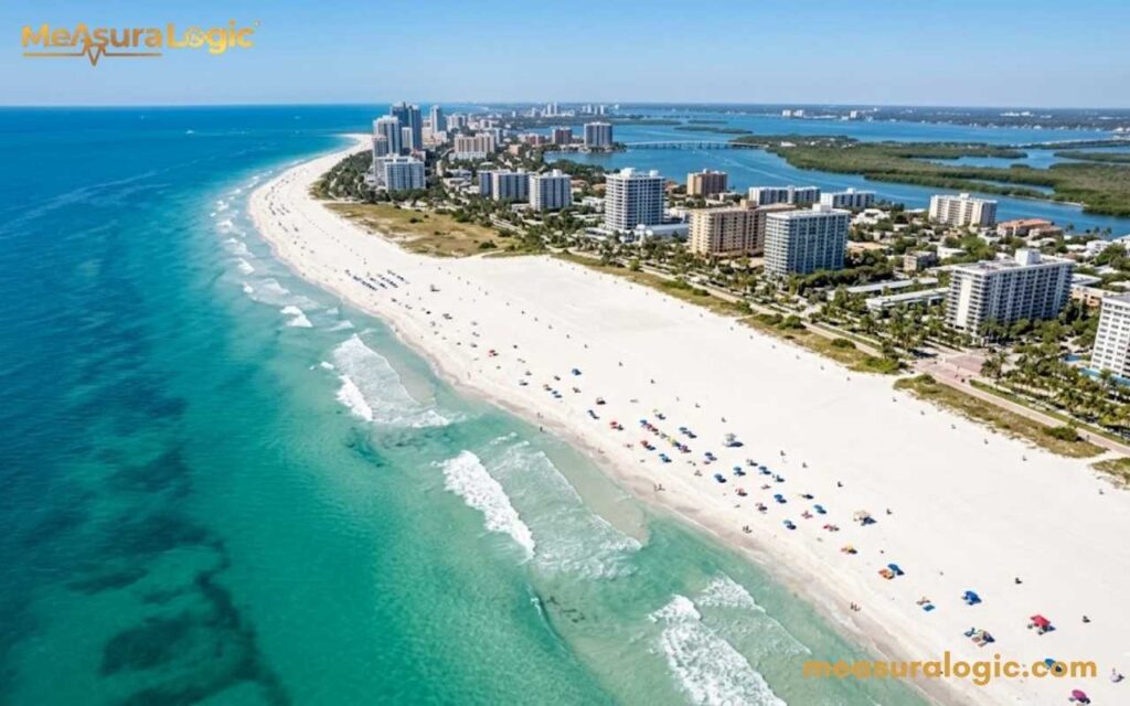
Florida boasts 1,350 miles of coastline — the third-longest of any U.S. state, trailing only Alaska and Louisiana. But that number only tells part of the story. When you factor in every bay, inlet, tidal river, and island shoreline, the tidal shoreline stretches an astonishing 8,436 miles.
Gulf Coast vs. Atlantic Coast
The two coasts are not interchangeable. They are genuinely different experiences:
| Feature | Gulf Coast | Atlantic Coast |
|---|---|---|
| Water Color | Emerald green / turquoise | Deep blue-green |
| Sand Color | Powdery white quartz | Lighter tan |
| Waves | Calm, gentle | More active surf |
| Water Temp | Warmer (avg. 73°F–86°F) | Slightly cooler |
| Famous Spots | Clearwater, Destin, Naples | Daytona, Fort Lauderdale, Palm Beach |
Famous Florida Beaches
Florida beaches are legendary for good reason. A few standouts:
- Siesta Key Beach — routinely ranked the #1 beach in the U.S. for its impossibly fine white sand
- Clearwater Beach — consistently wins “Best Beach” awards on the Gulf Coast
- South Beach, Miami — Atlantic shores with Art Deco backdrop and electric energy
- Fort Lauderdale Beach — 23 miles of white sand with a laid-back, sophisticated vibe
- Caladesi Island — only accessible by ferry, one of the most pristine stretches of coastline miles in the country
Explore About Lake Michigan: Guide to Size, Depth, Geography & Impact
Everglades National Park: A Wilderness That Defies Description
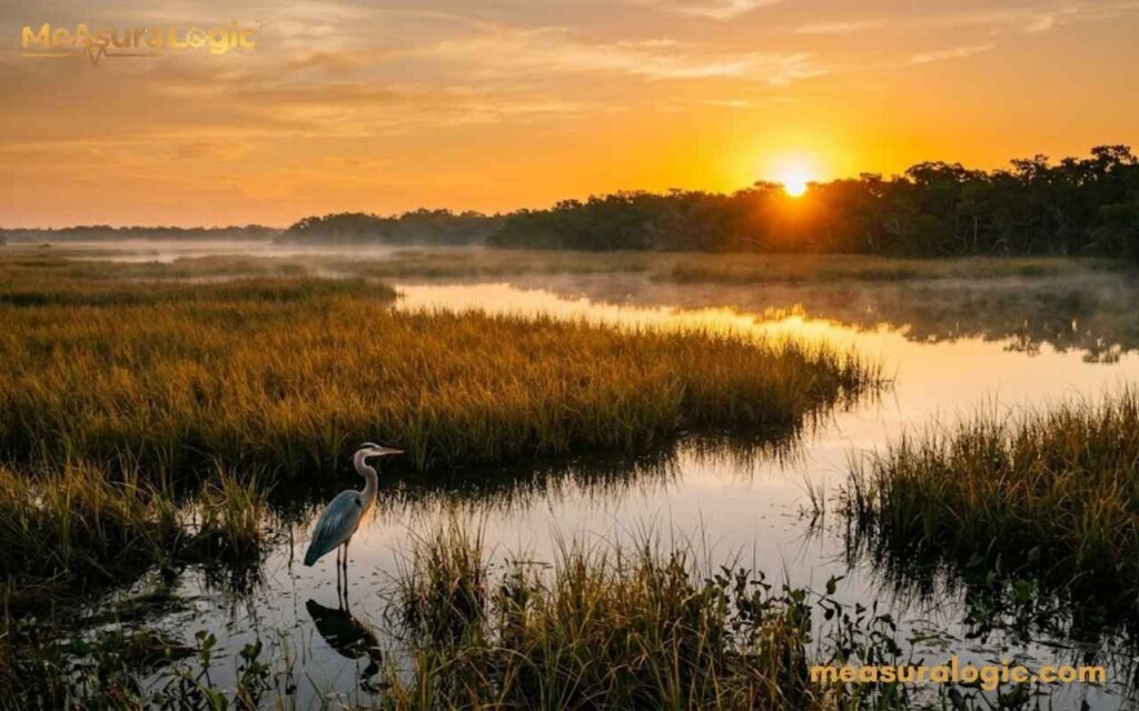
South of Lake Okeechobee, Florida transforms into something unlike anywhere else on Earth. Everglades National Park covers 1.5 million acres of sawgrass marshes, mangrove forests, and slow-moving subtropical water — a river of grass flowing imperceptibly southward toward the sea.
This national park protects:
- Over 360 species of birds
- Alligators and panthers — two apex predators sharing the same ecosystem
- The endangered Florida panther, with fewer than 200 individuals remaining in the wild
- Unique ecosystems found nowhere else on the planet
- Wetlands that filter water for millions of South Floridians
The Everglades span about 100 miles east to west and 50 miles north to south within the park boundaries — though the broader Everglades ecosystem covers far more territory. It is the largest subtropical wilderness in the United States and a UNESCO World Heritage Site.
How Florida Compares to Other States and Countries
Let’s put Florida’s area in sq miles (65,758) into real context.
| Location | Total Area | vs. Florida |
|---|---|---|
| Georgia | 59,425 sq mi | Smaller |
| New York | 54,555 sq mi | Smaller |
| England (UK) | 50,301 sq mi | Smaller |
| Greece | 50,949 sq mi | Smaller |
| Louisiana | 52,378 sq mi | Smaller |
| Pennsylvania | 46,054 sq mi | Smaller |
Florida is bigger than almost every U.S. state east of the Mississippi River. That is not a factoid, it fundamentally changes how you should plan your time here.
Key Geographic Features That Define Florida’s Landscape
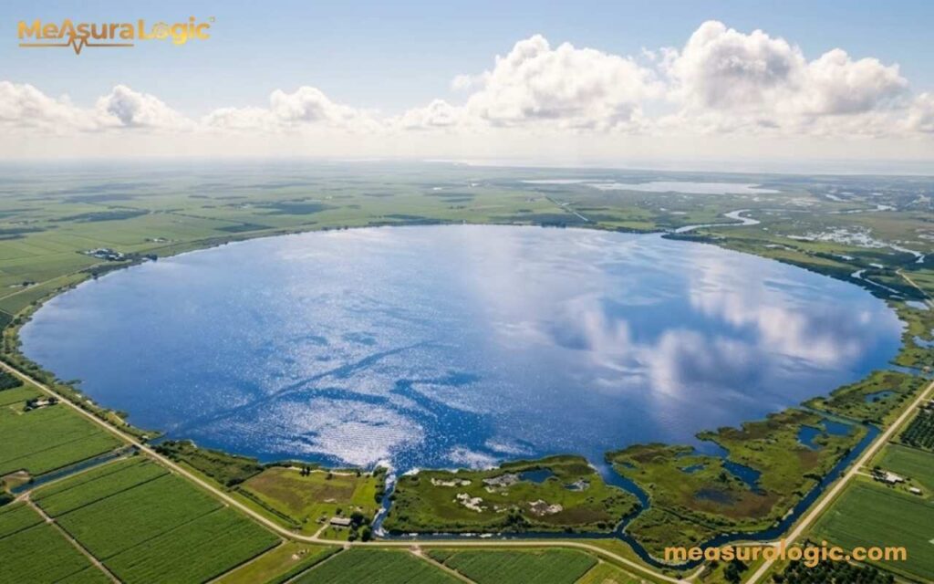
Lake Okeechobee
The second-largest freshwater lake entirely within the United States, Lake Okeechobee covers 730 square miles. It sits at the heart of South Florida‘s water system, feeding the Everglades and supplying water to millions of residents. Despite its enormous size, it averages only 9 feet deep — a massive, shallow saucer of freshwater in the middle of the peninsula.
Florida’s 700+ Natural Springs
Florida sits atop one of the world’s most extensive aquifer systems. Over 700 freshwater springs bubble up across the state, many maintaining a constant 68°F year-round — crystal clear and surrounded by lush subtropical greenery. Springs like Ginnie Springs, Ichetucknee, and Silver Springs are among the most stunning natural features in the vacation state.
Find about, Alaska Dimensions: How Big Is Alaska?
The Central Florida Ridge
A subtle spine of slightly elevated land runs through Central Florida, topping out around 300 feet. This ridge creates the geographic backbone of the Orlando region — the tourist center and theme park heart of the entire state. Walt Disney World alone covers 27,000 acres (43 square miles) in this region — bigger than San Francisco. Kennedy Space Center on the Atlantic coast adds another 140,000 acres of protected buffer land around NASA’s launch facilities at Cape Canaveral.
Climate Zones Across Florida’s Length
Florida’s north-to-south geography sprawl creates dramatically different climates within a single peninsula state:
| Region | Climate Type | January Avg Temp | July Avg Temp |
|---|---|---|---|
| Pensacola (Panhandle) | Humid Subtropical | 52°F | 82°F |
| Jacksonville | Humid Subtropical | 54°F | 82°F |
| Orlando (Central Florida) | Tropical-influenced | 61°F | 84°F |
| Miami (South Florida) | Tropical | 68°F | 84°F |
| Key West | Semi-tropical | 70°F | 85°F |
That is a 20°F temperature gap between north and south in January. Travelers who visit in winter expecting Sunshine State warmth sometimes land in Jacksonville wearing shorts and immediately regret it.
Population Density Across Florida’s Dimensions
Florida’s 22.6 million residents (2024 estimate) do not spread evenly across those 65,758 square miles. Most cluster along the coasts and the I-4 corridor — the highway connecting Tampa to Orlando to Daytona Beach that serves as the state’s demographic and political spine.
Major metro populations (2024 estimates):
- Miami Metro — ~6.2 million (the cultural melting pot of the Americas, heavy Latin influence)
- Tampa Bay Metro — ~3.2 million
- Orlando Metro — ~2.7 million (the beating heart of Central Florida and family fun)
- Jacksonville — ~1.6 million (city proper)
Jacksonville: America’s Largest City By Land Area
Here is perhaps the most jaw-dropping single fact about Florida dimensions: Jacksonville covers 874 square miles — making it the largest city by land area in the contiguous United States. It is larger than Los Angeles (503 sq mi) and New York City (302 sq mi). Even larger than Houston, Phoenix, and Chicago combined.
This happened in 1968 when Jacksonville merged with surrounding Duval County in a consolidation vote. One stroke of a pen created a geographic giant that still surprises urban planners and geography buffs alike.
Learn About, 2 Inches: 18 Everyday Items That Help You Visualize Measurement
Notable Universities and Hospitals in Florida

Top Universities
- University of Florida (Gainesville) — A top-10 public university nationally, consistently ranked among the best for research, medicine, and engineering programs.
- University of Miami (Coral Gables) — A globally recognized private research university known for its marine science, law, and business schools, sitting at the heart of South Florida’s academic scene.
Top Hospitals
- Mayo Clinic Florida (Jacksonville) — Ranked among the best hospitals in the entire country, offering world-class care across virtually every specialty in northern Florida.
- Jackson Memorial Hospital (Miami) — One of the largest public hospitals in the U.S., serving as the primary teaching hospital for the University of Miami’s medical school and a lifeline for South Florida’s diverse population.
Transportation and Sports & Recreation in Florida

Getting Around Florida
- Highways — Florida’s interstate network is extensive. I-95 runs the entire Atlantic shores length, I-75 cuts through Central Florida and South Florida, and I-10 connects the Florida Panhandle east to west.
- Airports — Miami International, Orlando International, and Tampa International rank among the busiest in the country, making Florida one of the most accessible vacation state destinations in the world.
Professional Sports
- NFL — Three franchises call Florida home: the Miami Dolphins, Jacksonville Jaguars, and Tampa Bay Buccaneers — spread across the state’s major metros.
- MLB — Florida hosts the Miami Marlins and Tampa Bay Rays, plus nearly half of all MLB teams use Florida for Spring Training every year — a tradition deeply woven into Florida history.
Outdoor Recreation
- Water Sports — With 1,350 miles of coastline, kayaking, paddleboarding, deep-sea fishing, and snorkeling spots in the Florida Keys draw millions annually.
- Nature Trails — Everglades National Park, Central Florida’s natural springs, and the Florida Trail (a 1,500-mile hiking route crossing the entire state) offer world-class outdoor adventures beyond the theme parks and Orlando attractions.
Learn about 18 Things That Are 9 Inches Long
Florida’s Geography Records Worth Knowing
Florida holds an impressive list of geographic distinctions:
- Longest coastline in the contiguous 48 states
- Flattest state in the U.S. (high point: 345 ft)
- Largest subtropical wilderness in the U.S. (Everglades)
- Only state with an extensive living coral reef in the continental U.S.
- Most lightning strikes per square mile annually in the entire country
- Largest city by land area in the contiguous U.S. (Jacksonville)
- Southernmost point in the contiguous U.S. (Key West)
Practical Travel Distances in Florida
Planning a Florida road trip? Here is what you actually need to know:
| Route | Distance | Drive Time (approx.) |
|---|---|---|
| Jacksonville → Miami | 345 miles | ~5.5 hours |
| Miami → Orlando | 235 miles | ~3.5 hours |
| Orlando → Tampa | 85 miles | ~1.5 hours |
| Tampa → Pensacola | 450 miles | ~6.5 hours |
| Miami → Key West | 160 miles | ~3.5 hours |
| Orlando → Kennedy Space Center | 58 miles | ~1 hour |
Pro tip: Never assume two Florida cities are “close” just because they are in the same state. This vacation state will humble your itinerary planning if you do not respect its actual scale.
Conclusion
Florida is not just bigger than you think, it is more varied, more complex, and more geographically fascinating than its postcard image suggests. Next time someone tells you Florida is just theme parks and retirees, show them this article. The numbers speak for themselves.
FAQs About Florida
Does Florida have any mountains or significant elevation changes?
No. Florida is the flattest state in the U.S., with its highest natural point (Britton Hill) sitting at just 345 feet above sea level.
Does Florida have a state income tax?
No. Florida is one of only nine U.S. states with zero state income tax — a major reason millions of people and businesses relocate here every year.
What language is most spoken in Florida after English?
Spanish, by a wide margin. Over 25% of Florida’s population speaks Spanish at home, reflecting the state’s deep Latin influence and close cultural ties to Cuba, Puerto Rico, and Colombia.
Read about, Coke Can Dimensions: Every Size, Height & Diameter (2026)

Maria Gold is an experienced blogger for Measura Logic, specializing in the fascinating world of dimensions. With a passion for clarity and precision, she breaks down complex concepts related to measurement, size, and spatial relationships. Her insightful articles help readers understand the true logic and implications of different dimensions, from the physical to the theoretical.