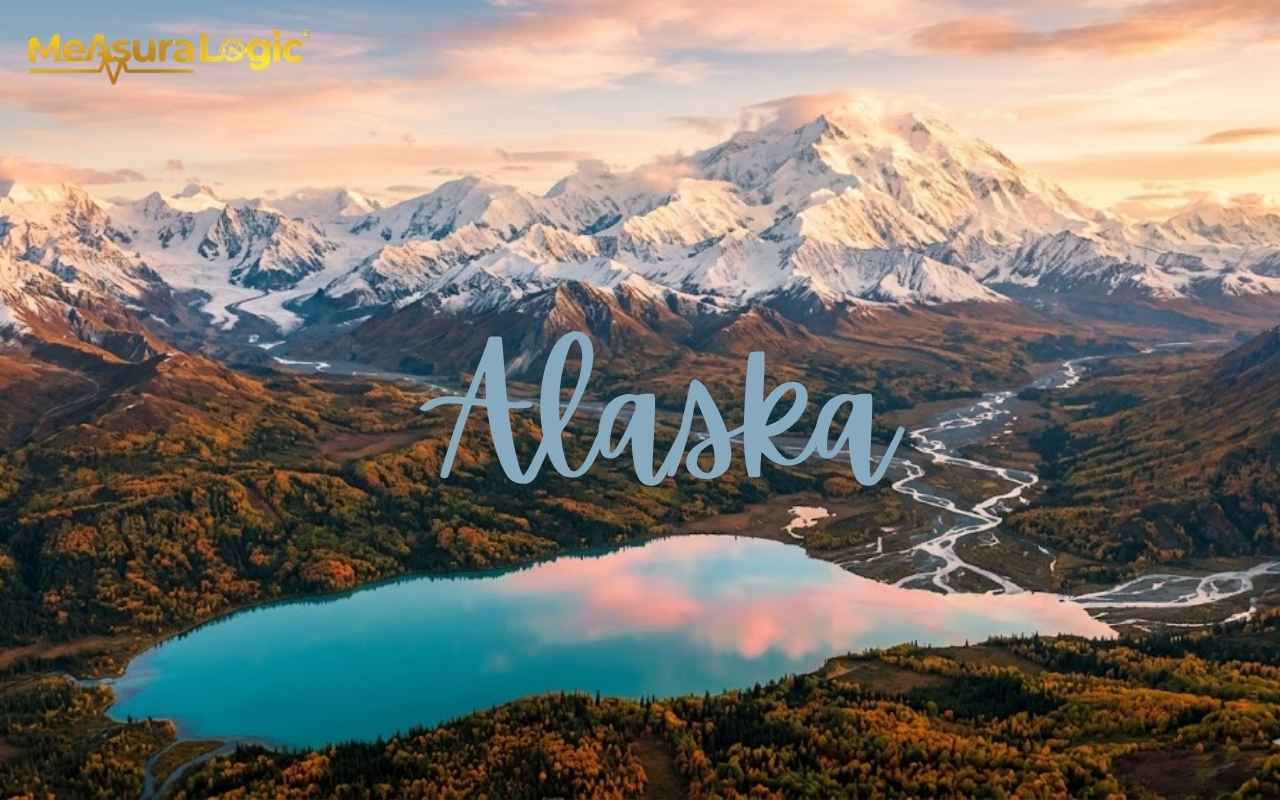
Most people know Alaska is big. But knowing it and feeling it are two very different things. When you actually dig into the Alaska dimensions and start comparing them to places you know, something shifts. The numbers stop being abstract. They become genuinely staggering.
So let’s do this right. No vague gestures at a map. Just clear, real comparisons that put Alaska’s size into proper perspective.
History of Alaska
Alaska’s peoples arrived over 15,000 years ago via the Bering Land Bridge. More than 20 distinct groups, including the Inupiaq, Yup’ik, Tlingit, and Athabascans, built rich cultures across the state’s diverse terrain. Russian explorer Vitus Bering made first European contact in 1741, kicking off a fur trade empire that made Sitka the capital of Russian America.
In 1867, Secretary of State William Seward purchased Alaska from Russia for just $7.2 million, roughly 2 cents per acre. Critics called it “Seward’s Folly.” They were wrong. Alaska became the 49th U.S. state on January 3, 1959, and when massive oil reserves were discovered at Prudhoe Bay in 1968, the purchase was confirmed as the greatest land deal in American history.
Find about 20 everyday Items That Are 7 Inches Long
Alaska by the Numbers
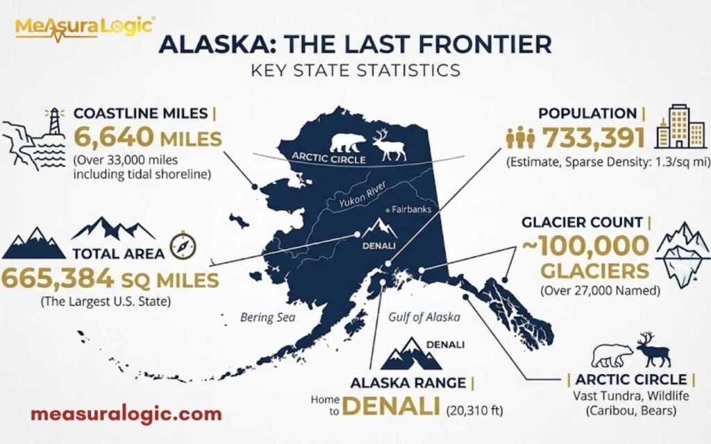
Before the comparisons, here is what we are working with. These are the core statistics that anchor everything else:
| Category | Value | Comparison / Insight |
|---|---|---|
| Total Area | 663,268 sq mi (1,723,337 km²) | 2.5× the size of Texas |
| Land Area | 571,951 sq mi | Majority of the state is land |
| Water Area | 91,316 sq mi | Huge number of lakes and rivers |
| Coastline Length | 33,904 miles | More than all other U.S. states combined |
| Highest Point | Denali – 20,310 ft | Tallest peak in North America |
| Longest River | Yukon River – 1,980 miles | One of the longest rivers in North America |
| Population (2023) | ~733,406 | Less than the city of Seattle |
| Population Density | 1.2 people per sq mi | One of the lowest in the world |
| Time Zones | 2 | Alaska Time & Hawaii-Aleutian Time |
| Lakes | 3+ million | More than any other U.S. state |
| Glaciers | 100,000+ | Covers ~5% of the state |
Alaska vs. Other U.S. States
Alaska vs. Texas is the comparison everyone reaches for and rightly so. Texas feels enormous but Alaska swallows Texas whole and still has room for California.
Want a really wild one? You could fit 19 U.S. states inside Alaska’s borders. Rhode Island fits inside 425 times. And yet it has fewer people than any other state except Wyoming.
Here is what it looks like next to its closest U.S. rivals:
| State | Area (sq mi) | Times Smaller Than Alaska |
|---|---|---|
| Texas | 268,596 | 2.5x |
| California | 163,696 | 4.1x |
| Montana | 147,040 | 4.5x |
| New Mexico | 121,590 | 5.4x |
| Rhode Island | 1,545 | 425x |
Alaska as Its Own Country — Where Would It Rank?
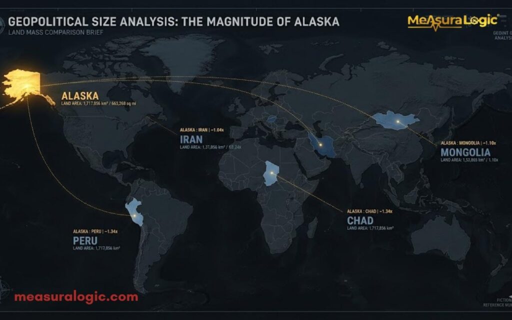
If its total area were a sovereign nation, it would rank as the 18th largest country on Earth. Consider what it surpasses:
Learn About Tiny House Dimensions: Complete Guide to Sizes and Layouts
- Larger than Iran (636,372 sq mi)
- Larger than Mongolia (603,909 sq mi)
- Larger than Peru (496,225 sq mi)
- Larger than Chad (495,755 sq mi)
- Bigger than all of Western Europe combined
Alaska vs. Europe is genuinely shocking. France, Germany, Spain, Italy, and the UK together cover about 650,000 square miles. Alaska is larger than all five of them stacked together.
Alaska vs. countries like Japan (145,936 sq mi) or Germany (137,988 sq mi) are not even close comparisons, Alaska is four to five times their size.
The population paradox is equally striking. Germany fits 84 million people into a space Alaska dwarfs. Alaska fits 733,000. That is not sparse. That is cosmic emptiness on a map with state lines.
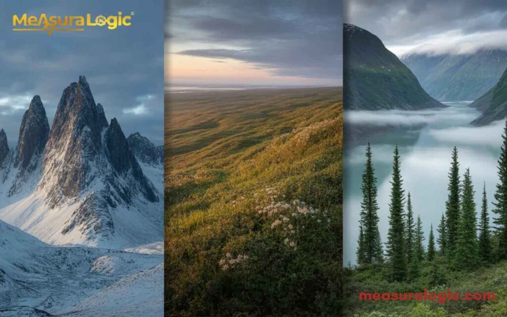
Geographic Deep Dive — What the Land Actually Looks Like
Alaska vs. U.S. Regions
Overlay Alaska onto the contiguous United States and it runs from Florida to California. Its eastern edge touches Minnesota. Its western tip stretches into the Pacific past Hawaii. That is not a metaphor — that is the literal Alaska map overlay when placed atop the lower 48.
How large is Alaska relative to U.S. regions? The American South — all of it — fits comfortably inside Alaska’s borders.
Alaska vs. Continents
- Alaska covers about 16% of the contiguous United States’ area
- It represents roughly 1.5% of the entire North American continent
- Alaska vs. Australia: Australia is about 10x larger, but Alaska covers more ground than Australia’s entire eastern seaboard states combined
Alaska vs. Famous Cities
- New York City fits inside Alaska over 300 times
- Los Angeles? Try 450 times
- Tokyo’s metro area fits inside Alaska roughly 200 times
The Alaska vs. major cities comparison works because cities feel real to us. Those numbers reframe the scale instantly.
Alaska’s Natural Scale
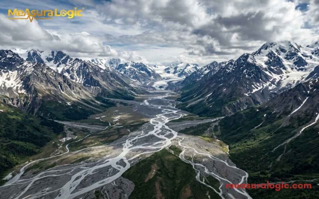
Denali and the Mountain Ranges
Denali stands at 20,310 feet above sea level. That makes it the highest peak in North America. But here is the fact most people miss: measured from base to summit, Denali is actually taller than Mount Everest. Everest rises about 12,000 feet from its Tibetan base. Denali rises roughly 18,000 feet from the surrounding lowlands.
Alaska does not have one mountain range. It has three massive systems:
- Alaska Range — home to Denali
- Brooks Range — cuts across the entire state above the Arctic Circle
- Chugach Mountains — framing Anchorage and Prince William Sound
The Wrangell Mountains add a fourth system, home to some of the continent’s most active volcanoes.
Learn about 19 Items That Are 12 Inches Long
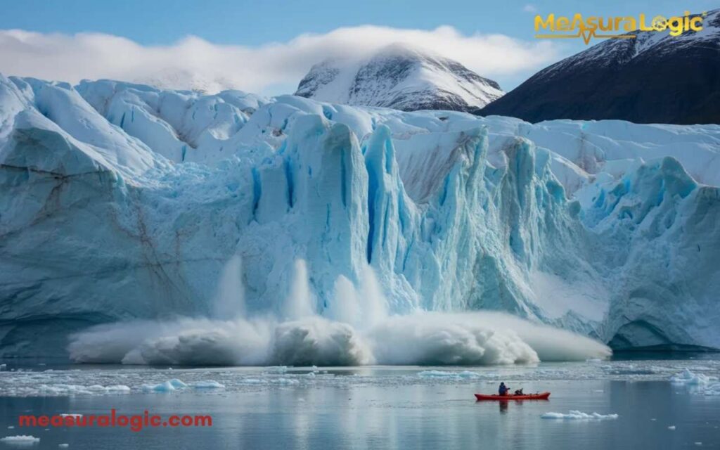
Alaska Glaciers
Alaska contains more glacial ice than the rest of the inhabited world combined.
That is not hyperbole. Alaska glaciers cover approximately 29,000 square miles — roughly 5% of the state’s total land area. There are over 100,000 individual glaciers.
The Malaspina Glacier alone is larger than Rhode Island. The Bering Glacier is the largest in North America at 2,000 square miles.
Alaska glaciers coverage is shrinking — most have retreated measurably since the 1950s — but what remains is still the largest concentration of glacial ice outside the polar ice caps.
Rivers and Lakes
- Alaska has over 3 million lakes
- Lake Iliamna — Alaska’s largest lake — covers 1,014 square miles, roughly the size of Rhode Island (yes, Rhode Island fits everywhere in this article)
- The Yukon River stretches 1,980 miles, making it one of the longest rivers in North America
- Becharof Lake, the second largest in Alaska, covers 458 square miles
Alaska Coastline Length
Alaska’s coastline length clocks in at 33,904 miles. The rest of the continental United States? About 12,383 miles combined. Alaska alone has nearly three times the coastline of the entire lower 48.
Why so much? The state’s southern edge is fractured into thousands of islands, fjords, and tidal inlets — particularly in Southeast Alaska. The Aleutian Islands chain alone stretches 1,200 miles into the Pacific.
Wildlife Habitats and Biodiversity at Scale
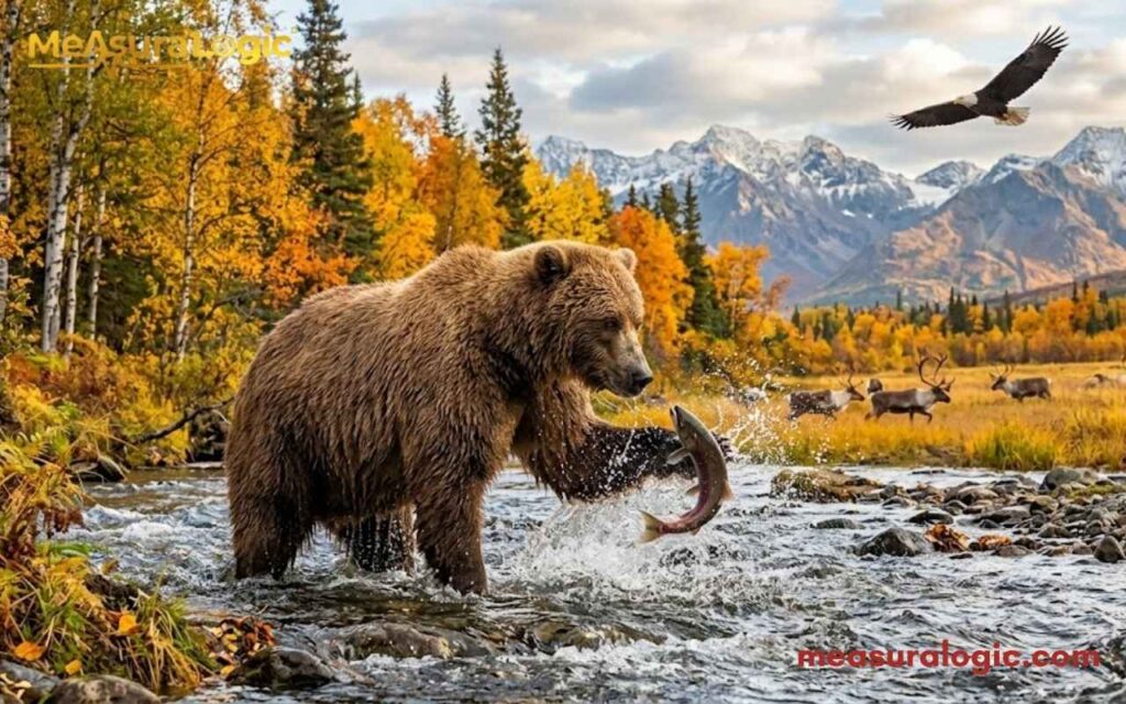
Alaska’s geography does not just look impressive — it functions differently because of its size. Ecosystems that coexist nowhere else on Earth thrive here because the land simply has enough room.
Some quick facts:
- Alaska is home to over 30,000 brown bears — roughly 95% of the entire U.S. brown bear population
- Caribou herds migrate 700–800 miles annually — distances that cross entire European countries
- The state hosts 400+ species of birds
- Seabird colonies in the Aleutians number in the millions
Wildlife in Alaska is not an attraction you go looking for. Out there, you are the visitor in someone else’s territory.
Read about 17 Common Things That Are 18 Inches Long (Real Life Examples)
National Parks
Alaska national parks dominate every size ranking in the U.S. system. Eight of the ten largest national parks in America are in Alaska.
| National Park | Size (sq mi) | Comparable To |
|---|---|---|
| Wrangell-St. Elias | 20,587 | Switzerland |
| Gates of the Arctic | 13,238 | Maryland |
| Denali | 9,492 | New Hampshire |
| Katmai | 6,395 | Connecticut |
| Lake Clark | 6,295 | Hawaii |
| Kobuk Valley | 2,736 | Delaware |
Wrangell-St. Elias National Park is the largest national park on Earth. It is six times the size of Yellowstone. You could drop Switzerland inside it with room to spare.
Gates of the Arctic has zero roads and zero visitor centers. You access it by bush plane. It exists at a scale that essentially renders conventional tourism meaningless.
Alaska’s Size in Daily Life
Travel and Connectivity Challenges
Here is what its travel distances mean practically:
- Over 200 communities in Alaska have no road access whatsoever
- The only way in or out is by plane or boat
- Bush planes are not a luxury or a novelty — they are the postal service, the ambulance, and the grocery delivery system rolled into one
Alaska’s road system covers a state this size with a highway network roughly equivalent to a mid-sized U.S. state. The Alaska Highway connects the state to Canada and the lower 48 — but it is long, demanding, and cuts through genuinely remote terrain.
Getting Around — Real Travel Times
| Route | Method | Time |
|---|---|---|
| Anchorage to Fairbanks | Car (358 miles) | ~6.5 hours |
| Anchorage to Juneau | No road exists | Must fly or ferry |
| Fairbanks to Barrow | Air only | ~2 hours by plane |
| Anchorage to Nome | Air only | ~1.5 hours by plane |
Anchorage to Fairbanks distance sounds manageable until you realize the road north is the only one. And if you are heading to Juneau — Alaska’s own capital city — you literally cannot drive there from the rest of the state. Alaska transportation runs on a different logic entirely.
The Alaska Railroad connects Seward to Fairbanks through some of the most spectacular terrain on the planet. But it is as much a lifeline as it is a tourist experience.
Remote Living
Communities like Bethel, Nome, and Utqiaġvik (formerly Barrow) sit in conditions that reshape daily life entirely:
- Heating fuel often costs $7–$10 per gallon — double or triple Anchorage prices
- A bag of groceries in a remote village can cost 2–3x the Anchorage price
- Utqiaġvik experiences 67 consecutive days of midnight sun in summer and nearly as long without it in winter
- Alaska’s remote areas operate on a cash economy, community networks, and subsistence hunting that has sustained Indigenous peoples for thousands of years
Read about 16 Things That Are 100 Feet (ft) Long
Population Density
Alaska’s population density stands at 1.2 people per square mile. Compare that to:
- New Jersey: 1,263 people per square mile
- California: 254 people per square mile
- Texas: 111 people per square mile
Anchorage alone holds nearly 40% of Alaska’s entire population. Step outside that metro area and the sparsely populated regions stretch for hundreds of miles in every direction.
This is what “vast wilderness Alaska” actually means in demographic terms. Most of the state is, functionally, empty.
Alaska’s Economic Footprint
The state’s natural resources drive an economy that punches far above its population weight:
- Oil: The Trans-Alaska Pipeline stretches 800 miles from Prudhoe Bay to Valdez. Since 1977, it is moved over 17 billion barrels of crude oil. Alaska oil production peaked in the late 1980s at 2 million barrels per day
- Fishing: Alaska’s fishing industry produces over 60% of all wild-caught seafood in the United States. Salmon, pollock, crab — Alaska dominates
- Mining: Gold, zinc, coal, and copper remain significant contributors. The Red Dog Mine is one of the world’s largest zinc operations
- Tourism in Alaska generates over $2 billion annually. Cruise ships, wilderness lodges, aurora chasers, and sport fishermen fuel a growing sector
- The Permanent Fund Dividend — a direct payment to every Alaska resident from oil revenues — paid $1,312 per person in 2023
Higher Education
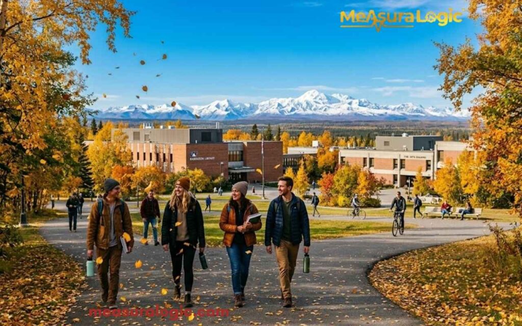
Despite its remote reputation, Alaska maintains strong academic institutions:
- University of Alaska Fairbanks (UAF) — the flagship campus, ranked among the world’s top universities for Arctic and polar research. Founded 1917
- University of Alaska Anchorage (UAA) — the largest campus by enrollment, offering over 150 programs across health, business, and engineering
- University of Alaska Southeast (UAS) — based in Juneau, specializing in marine biology, education, and business
- Alaska Pacific University — a private liberal arts university in Anchorage, focused on outdoor studies and environmental science
These institutions punch well above their weight in Arctic research, Indigenous studies, and environmental science — fields where Alaska’s geography is a living laboratory.
Healthcare Infrastructure

Learn about, 20 Feet: 24 Real Things That Are About This Long
Serving a geographically massive, sparsely populated state creates unique healthcare challenges. Key institutions include:
- Providence Alaska Medical Center (Anchorage) — the largest hospital in the state, with 401 beds and Level II trauma center designation
- Alaska Regional Hospital (Anchorage) — a 250-bed facility and major cardiac care center
- Bartlett Regional Hospital (Juneau) — the primary hospital for Southeast Alaska, serving communities often reachable only by air
Telemedicine plays a critical role across remote areas in Alaska where the nearest hospital may be a 2-hour flight away.
Surprising Facts About alaska
Before wrapping up, here are a few facts that do not fit neatly into any category but absolutely belong in any serious discussion of this state:
- It is simultaneously the westernmost, easternmost, and northernmost U.S. state. (The Aleutian Islands cross the 180th meridian, technically placing it in the Eastern Hemisphere)
- It has more FAA-registered pilots per capita than any other state, about 1 in 78 Alaskans holds a pilot’s license.
- The state has more active volcanoes (over 130) than the rest of the United States combined.
- Utqiaġvik experiences 67 straight days of midnight sun and roughly 67 days of polar night.
- Alaska’s Aleutian Islands stretch so far west that some islands sit closer to Tokyo than to Anchorage.
Quick Quiz
Think you have absorbed all those mind-bending numbers? Try this:
How many Rhode Islands fit inside this state?
(a) 50 (b) 200 (c) 425)
What is Alaska’s coastline length in miles?
(a) 12,000 (b) 33,904 (c) 18,500)
Which national park is larger than Switzerland?
(a) Denali (b) Katmai (c) Wrangell-St. Elias)
Answers: 1-c, 2-b, 3-c
Conclusion
Alaska is not just the largest U.S. state, it is a place that fundamentally breaks your mental map of what a single landmass can contain: 100,000 glaciers, 3 million lakes, 33,904 miles of coastline, and fewer people than Seattle, all packed into a wilderness so vast it dwarfs entire nations.
Frequently Asked Questions
1. Does Alaska have a land border with any U.S. state?
No. Alaska shares land borders only with Canada — specifically Yukon and British Columbia. It is completely separated from the contiguous United States.
2. What language do most speak here?
English is the primary language. However, Alaska officially recognizes 20 Indigenous languages, including Yup’ik, Inupiaq, and Tlingit — more than any other U.S. state.
3. Is it bigger than the entire European Union?
Almost. The EU covers roughly 1.6 million square miles across 27 countries. Alaska at 663,268 square miles is smaller than the full EU but larger than any single EU member nation, including France and Germany.
Explore About Lake Michigan: Guide to Size, Depth, Geography & Impact

Maria Gold is an experienced blogger for Measura Logic, specializing in the fascinating world of dimensions. With a passion for clarity and precision, she breaks down complex concepts related to measurement, size, and spatial relationships. Her insightful articles help readers understand the true logic and implications of different dimensions, from the physical to the theoretical.