
Chicago stands among the most influential cities in the United States. People often ask a simple question: How big is Chicago? At first glance, the answer seems straightforward. The city covers hundreds of square miles, hosts millions of residents, and stretches along the southwestern edge of one of the largest freshwater systems on Earth.
However, numbers alone do not tell the full story.
This guide breaks down Chicago’s real dimensions. You will explore its city limits, population density, neighborhoods, waterfront geography, transportation network, and cultural landmarks. By the end, you will understand why this iconic Midwestern metropolis remains one of America’s most influential urban centers.
Chicago’s Geographic Location and Natural Setting

Chicago sits on the southwestern shore of Lake Michigan, one of the five massive Great Lakes that form the largest freshwater system on Earth. This position shaped the city’s history, climate, transportation routes, and economy.
The city lies in the state of Illinois, roughly in the heart of the American Midwest. Because of its location, Chicago became a natural crossroads for railroads, waterways, and highways connecting the eastern and western United States.
Geographic Coordinates
| Detail | Value |
|---|---|
| Latitude | 41.8781° N |
| Longitude | 87.6298° W |
| Elevation | ~594 feet above sea level |
| Region | Midwestern United States |
This location places Chicago near major trade routes linking the Atlantic Ocean, the Mississippi River Basin, and the Great Lakes.
Why the Location Matters
Chicago’s position gave it enormous economic power during the 19th century. Ships could move goods across Lake Michigan, railroads carried cargo inland, and canals linked the Chicago River to the Mississippi watershed.
This combination turned the city into an urban hub and earned it the nickname “Third City,” referring to its historic ranking as America’s third largest city.
Another famous label also stuck: the Windy City. Although the name sometimes refers to breezy lakefront weather, historians say it originally described Chicago’s outspoken politicians.
Either way, the nickname remains one of the most recognizable city monikers in the world.
Explore About Pringles Can Dimensions and Size
Climate and Weather Patterns
Chicago’s weather reflects its proximity to Lake Michigan, which influences seasonal temperatures and creates the famous breezy weather.
| Season | Characteristics |
|---|---|
| Winter | average lows of 18°F with heavy snowfall, especially near the lake. |
| Spring | milder temperatures and unpredictable weather, with sudden shifts between warmth and chilly breezes. |
| Summer | average high of 85°F, accompanied by high humidity and occasional thunderstorms. |
| Fall | milder temperatures and unpredictable weather, with sudden shifts between warmth and chilly breezes. |
Temperatures near the waterfront often remain cooler in summer and slightly warmer during winter.
These natural climate patterns shaped the city’s architecture and public spaces, especially the extensive waterfront trails and lakeside parks.
How Big Is Chicago in Square Miles?

Chicago covers a large geographic footprint compared with many dense urban centers.
Total Area of Chicago
| Category | Size |
|---|---|
| Total Area | 234.5 square miles |
| Land Area | 227.7 square miles |
| Water Area | 6.8 square miles |
These figures make Chicago one of the largest cities in the United States by total area.
To visualize this size:
- Chicago is larger than Paris in land area.
- The city is smaller than Los Angeles, which spreads across more than 500 square miles.
- Chicago remains far denser than many American cities despite its large footprint.
Chicago’s Physical Dimensions
The city’s shape stretches more in one direction than the other.
| Direction | Approximate Distance |
|---|---|
| North to South | ~26 miles |
| East to West | ~14 miles |
These distances show how Chicago forms a long vertical urban corridor along Lake Michigan.
What the Numbers Mean in Real Life
Consider this perspective:
- Walking from the northern edge of the city to the southern boundary would take nearly nine hours nonstop.
- Driving across the city during rush hour can easily take 90 minutes or more.
So while Chicago may not cover the most square miles among U.S. cities, its urban stretch still feels massive when experienced on the ground.
Chicago’s Natural Borders and Waterfront
Few American cities enjoy a waterfront as dramatic as Chicago’s.
Lake Michigan: The City’s Eastern Edge

The enormous Lake Michigan forms Chicago’s eastern boundary. This freshwater lake contains about 1,180 cubic miles of water and ranks among the largest lakes in the world.
For Chicago residents, the lake functions almost like an ocean.
Key Facts About Lake Michigan
| Feature | Statistic |
|---|---|
| Surface Area | 22,400 square miles |
| Maximum Depth | 923 feet |
| Shoreline Length | 1,640 miles |
| Chicago Lakefront | ~26 miles |
Chicago built much of its identity around this massive body of water.
The lakefront includes:
- Public beaches
- Waterfront trails
- Scenic parks
- Marinas and harbors
- Recreation areas
The lake breezes also influence the city’s weather patterns, often cooling neighborhoods near the waterfront during summer months.
Chicago River: Engineering Marvel
Another defining geographic feature is the Chicago River, which flows directly through downtown.
Originally, the river drained into Lake Michigan, causing severe sanitation problems. In one of the most ambitious engineering projects of the 19th century, the city literally reversed the river’s flow in 1900.
This massive project redirected wastewater away from the lake and protected Chicago’s drinking water supply.
Key Facts About the Chicago River
| Feature | Detail |
|---|---|
| Length | ~156 miles including branches |
| Historic Project | River reversal in 1900 |
| Engineering Impact | Major sanitation breakthrough |
Today the river forms an iconic urban corridor filled with:
- Riverwalk parks
- Restaurants
- Kayak routes
- Architectural boat tours
The project stands as one of the most impressive feats of sanitation engineering in American history.
Find about 4 inches measurement
Chicago’s Street Grid and Urban Layout
Chicago’s layout makes navigation surprisingly simple for a city this large.
The city uses a precise grid system where streets run north-south and east-west. The center of the grid sits at State Street and Madison Street, located in downtown Chicago.
Every address corresponds to a distance from that central intersection.
How the Grid Works
| Distance | Measurement |
|---|---|
| 800 address numbers | 1 mile |
| 8 city blocks | ~1 mile |
This system means you can estimate distance instantly.
For example:
- 1600 North = two miles north of Madison
- 4000 West = five miles west of State Street
This organized urban layout allows Chicago residents to navigate the city quickly without GPS.
Urban planners often cite Chicago’s grid as one of the most efficient city designs in North America.
Chicago Population and Urban Density

Chicago remains one of the most populated cities in the United States.
Population Statistics
| Category | Number |
|---|---|
| Population (2024 estimate) | ~2.7 million |
| Metropolitan Area | ~9.5 million |
| Rank in U.S. | Third largest city |
Because of this large population packed into a relatively limited land area, Chicago maintains a high population density.
Population Density
| Metric | Value |
|---|---|
| People per square mile | ~11,800 |
| Dense areas | Downtown Loop |
| Lower density | Outer neighborhoods |
The Loop, Chicago’s central business district, contains some of the most crowded blocks in the country during workdays.
Meanwhile, neighborhoods farther from downtown feature quieter residential streets, parks, and historic homes.
This balance creates the unique neighborhood variation that defines Chicago’s character.
Chicago’s 77 Community Areas
Chicago divides itself into 77 official community areas, sometimes casually referred to as neighborhoods.
These community areas help with local governance, city planning, and census data collection.
Why Community Areas Matter
Each area has its own identity, culture, and demographics. Together they form a city made up of dozens of smaller communities.
Some of the most well-known include:
- Lincoln Park – lakefront parks and historic homes
- Hyde Park – home to the University of Chicago
- Bronzeville – center of African American cultural history
- Pilsen – vibrant Latino arts district
These 77 neighborhoods create a rich mosaic of culture and local traditions.
Example Community Areas
| Area | Known For |
|---|---|
| Lincoln Park | Parks and lakefront views |
| Hyde Park | Academic institutions |
| Pilsen | Murals and art scene |
| Bronzeville | Historic jazz heritage |
Walking between these districts can feel like traveling between entirely different cities.
Chicago Compared With Major U.S. Cities
Looking at Chicago in comparison with other cities provides helpful context.
Size Comparison
| City | Land Area |
|---|---|
| Chicago | 227 square miles |
| New York City | 302 square miles |
| Los Angeles | 503 square miles |
| Boston | 48 square miles |
Chicago falls in the middle among major American cities in terms of land area.
However, Chicago maintains a higher population density than many larger cities.
Chicago Compared With Global Cities
Chicago also compares well with major international capitals.
| Global City | Land Area |
|---|---|
| Chicago | 227 sq miles |
| Paris | 41 sq miles |
| London | 607 sq miles |
Although London covers a larger metropolitan footprint, Chicago’s downtown skyline remains one of the most recognizable in the world.
Transportation and Getting Across Chicago

Because Chicago stretches across hundreds of square miles, efficient transportation is essential.
The city built one of the most extensive transit networks in North America.
Public Transportation System
Chicago’s transit system includes several major components:
- CTA L trains
- Metra trains
- Bus routes
- Divvy bikes
Together, these networks provide extensive public transportation access across the metropolitan area.
Chicago Transit Facts
| System | Coverage |
|---|---|
| CTA L Trains | Rapid transit across city |
| Metra | Regional commuter rail |
| Bus Routes | Over 100 lines |
| Divvy Bikes | Thousands of rental bikes |
Many residents commute daily using trains rather than cars.
Major Airports
Chicago also serves as a major global aviation hub.
| Airport | Role |
|---|---|
| O’Hare Airport | One of the world’s busiest airports |
| Midway Airport | Domestic travel hub |
Flights from O’Hare connect Chicago to cities across six continents.
Chicago’s Historic Growth and the Great Chicago Fire
The modern city skyline exists largely because of one dramatic event.
The Great Chicago Fire of 1871
In October 1871, a devastating blaze swept through the city.
The Great Chicago Fire destroyed roughly:
- 3.3 square miles of urban area
- 17,000 buildings
- 100,000 homes
Despite the destruction, the disaster sparked an era of ambitious rebuilding.
Architects introduced new steel-frame construction techniques that allowed buildings to rise higher than ever before.
This innovation gave birth to the modern skyscraper.
Chicago and the Birth of the Skyscraper
Visionary architects such as Louis Sullivan helped pioneer vertical building design. Within a few decades, Chicago’s skyline transformed dramatically.
Today Chicago’s skyline ranks among the tallest in the world. Visitors standing on the Skydeck can see four U.S. states on clear days.
Healthcare Systems and Major Hospitals
Chicago’s healthcare network is one of the most advanced in the Midwest, combining major hospitals, specialty clinics, and research institutions. Several hospitals collaborate with top universities to integrate patient care with medical innovation.
Chicago provides advanced services in cardiology, oncology, trauma care, and organ transplantation, attracting patients from across the region and beyond.
| Hospital / Network | Specialties | University Affiliation |
|---|---|---|
| Northwestern Memorial Hospital | Cardiology, neurology, trauma | Northwestern University |
| University of Chicago Medical Center | Oncology, organ transplant | University of Chicago |
| Rush University Medical Center | Orthopedics, rehabilitation | Rush University |
| Lurie Children’s Hospital | Pediatrics, rare diseases | Affiliated with multiple local universities |
| Advocate Christ Medical Center | Cardiac care, emergency medicine | Regional healthcare network |
These institutions make Chicago a regional healthcare hub, combining high-quality patient care with world-class medical research and training programs.
Learn about everyday objects that weigh 10 pounds
Famous Landmarks That Define Chicago’s Scale

Chicago’s skyline and attractions highlight the city’s impressive size and influence.
Willis Tower
One of the most famous buildings is Willis Tower, once known as the Sears Tower.
| Feature | Statistic |
|---|---|
| Height | 1,450 feet |
| Floors | 110 |
| Observation Deck | Skydeck |
The glass observation ledge allows visitors to step out over the city more than 1,300 feet above ground.
From this height, Chicago’s vast urban footprint becomes clear.
Millennium Park
Another iconic location is Millennium Park, located in downtown Chicago.
The park features the famous sculpture Cloud Gate, commonly known as “The Bean.”
Visitors gather here to photograph the mirrored artwork reflecting the surrounding skyline.
Navy Pier
Along the Lake Michigan waterfront, Navy Pier serves as one of the city’s most popular attractions.
This entertainment complex includes:
- Ferris wheel rides
- Museums
- Restaurants
- Boat tours
The pier attracts millions of visitors every year and remains a major tourism magnet.
Magnificent Mile
For shopping enthusiasts, the Magnificent Mile ranks among the most famous retail districts in the United States.
This stretch of Michigan Avenue offers:
- Luxury boutiques
- Flagship stores
- Upscale dining
- Historic architecture
It also sits near the upscale River North neighborhood, known for its galleries and chic restaurants.
Accommodation and Tourism Infrastructure
Chicago’s hospitality sector serves millions of visitors each year, combining modern skyscraper hotels with historic properties and boutique accommodations.
The city prioritizes walkability and easy access to attractions such as Millennium Park, Navy Pier, and the Magnificent Mile, making it convenient for tourists to explore on foot or by public transit. Seasonal festivals, architecture tours along the Chicago River, and lakefront events enhance visitor experiences, solidifying the city as a global tourism magnet.
| Feature | Highlight |
|---|---|
| Hotel Capacity | Over 120,000 rooms across downtown and suburbs |
| Convention Centers | McCormick Place – largest in North America |
| Walkable Districts | Loop, River North, Magnificent Mile |
| Waterfront Access | Lakefront hotels with scenic views |
| Tourist Activities | Festivals, architecture cruises, Riverwalk, sports events |
Chicago’s Academic Influence
Chicago houses some of the most respected universities in the world.
University of Chicago

Located in Hyde Park, the University of Chicago stands as a global leader in research and education.
Notable achievements include:
- Dozens of Nobel Prize winners
- Leading economic research programs
- Renowned law and public policy schools
Read about 10 inches long objects with a clear visual guide.
The campus also helped shape Hyde Park into one of the city’s most intellectually vibrant districts.
Northwestern University
Just north of the city sits Northwestern University in Evanston.
The university is widely known for:
- Prestigious law programs
- Top journalism schools
- Advanced medical research
These institutions contribute to Chicago’s reputation as a center of rigorous academic scholarship.
Chicago’s Cultural Scene
Chicago’s cultural identity blends history, food, music, and art.
Art Institute of Chicago
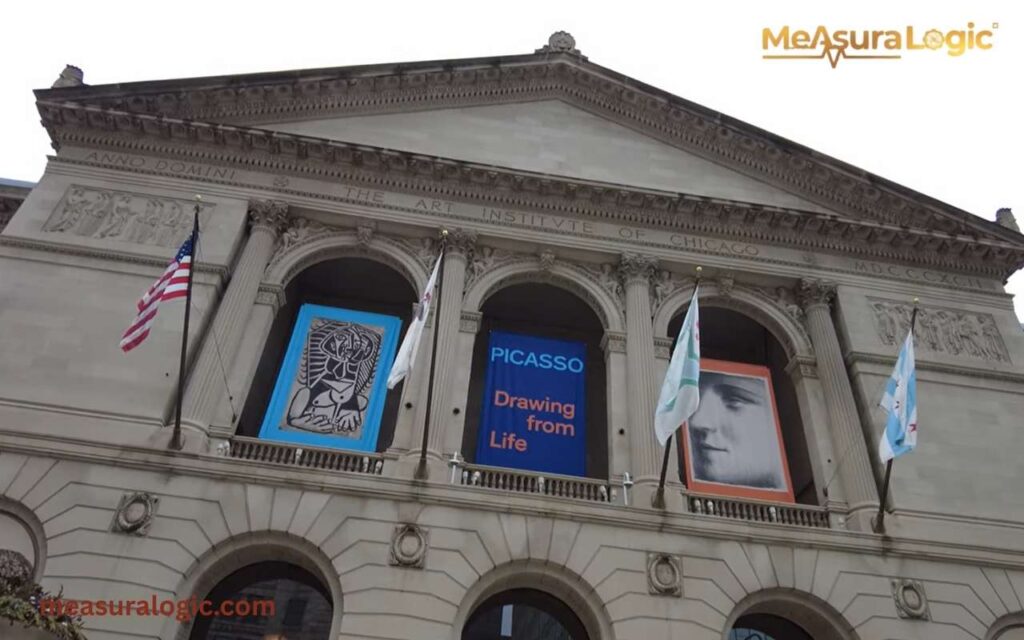
The Art Institute of Chicago ranks among the most respected art museums in the world.
The museum houses masterpieces including:
- Impressionist paintings
- The iconic American Gothic painting
- Extensive Asian and African art collections
Millions of visitors explore the museum every year.
Music and Performing Arts
Chicago helped shape several musical genres:
- Jazz
- Blues
- House music
Legendary venues across the city still host live performances almost every night.
Food Culture: Deep Dish Pizza and More

Chicago cuisine deserves its own spotlight.
Deep Dish Pizza
Perhaps the most famous local dish is Deep Dish Pizza.
Unlike thin crust pizza, Chicago’s version uses:
- A thick buttery crust
- Layers of cheese
- Chunky tomato sauce on top
Restaurants like Pizzeria Uno helped popularize this Chicago style pizza worldwide.
The result is a rich, cheesy, towering pizza that looks more like a savory pie than traditional pizza.
Other Iconic Dishes
Chicago also features several beloved foods:
- Chicago-style hot dogs
- Italian beef sandwiches
- Garrett popcorn
Together these iconic dishes form an important part of the city’s local culture.
Fun Facts About Chicago
- Chicago invented the skyscraper – The Home Insurance Building, completed in 1885, is widely recognized as the world’s first steel-framed skyscraper.
- Chicago has a hidden beach system – Beyond the popular downtown shoreline, the city has over 15 public beaches along Lake Michigan, some tucked away in quiet neighborhoods.
- A city of bridges – Chicago has more movable bridges than any other city in the world, with more than 50 spanning the Chicago River to allow boat traffic to pass.
Read about how long is 5 inches?
Why Chicago Feels Larger Than Its Size
Chicago’s physical area tells only part of the story.
Several factors make the city feel far bigger than its square miles suggest:
- A massive metropolitan population
- Major international airport connections
- Global finance and commerce influence
- Cultural institutions and museums
- World-class architecture
Chicago continues to function as one of North America’s most powerful urban centers.
Key Facts About Chicago at a Glance
| Feature | Statistic |
|---|---|
| Total Area | 234.5 square miles |
| Population | ~2.7 million |
| Metro Population | ~9.5 million |
| Lakefront | ~26 miles |
| Community Areas | 77 |
| Population Density | ~11,800 per square mile |
Take the Chicago Challenge
Think you know Chicago? Test your city smarts with this quick interactive challenge:
Guess the Answer:
- How many official community areas does Chicago have?
- Which Chicago landmark allows you to see four states on a clear day?
- What iconic Chicago food is baked with a thick crust and chunky tomato sauce?
Check Your Answers Below:
- 77 community areas
- Willis Tower Skydeck
- Deep Dish Pizza
Challenge yourself: Next time you walk along the Lake Michigan waterfront or explore a neighborhood, try spotting these landmarks and see if you can answer more local trivia like a true Chicagoan!
Final Thoughts
Chicago’s size is more than just 234 square miles or its population of 2.7 million. It’s a city of neighborhoods, culture, and history, stretching from the Lake Michigan waterfront to vibrant community districts. Its architecture, parks, universities, and transportation networks all contribute to a city that feels far larger than its official borders.
From the towering Willis Tower to the bustling streets of the Magnificent Mile, Chicago combines scale with character. The Windy City continues to grow, innovate, and inspire, proving that its true size is measured not only in square miles but in influence, diversity, and unforgettable experiences.
FAQs About Chicago
1. What is Chicago’s official nickname besides “Windy City”?
Chicago is also called the “Second City”, a nickname that originated from the city’s rapid rebuilding after the Great Chicago Fire and its historical role as the nation’s second-largest urban hub in certain periods.
2. Does Chicago have any unique public festivals or events?
Yes, Chicago hosts many signature events such as the Taste of Chicago, Lollapalooza, and the Chicago Air and Water Show, attracting millions of visitors annually and highlighting the city’s cultural diversity.
3. Are there any unique natural features within Chicago besides Lake Michigan?
Yes, Chicago features natural areas like the Calumet River wetlands, Jackson Park’s lagoons, and the Indiana Dunes National Park nearby, offering urban residents and visitors scenic outdoor spaces within and just outside city limits.
Learn about New York City: Dimensions, Population, and Essential Facts

Maria Gold is an experienced blogger for Measura Logic, specializing in the fascinating world of dimensions. With a passion for clarity and precision, she breaks down complex concepts related to measurement, size, and spatial relationships. Her insightful articles help readers understand the true logic and implications of different dimensions, from the physical to the theoretical.